
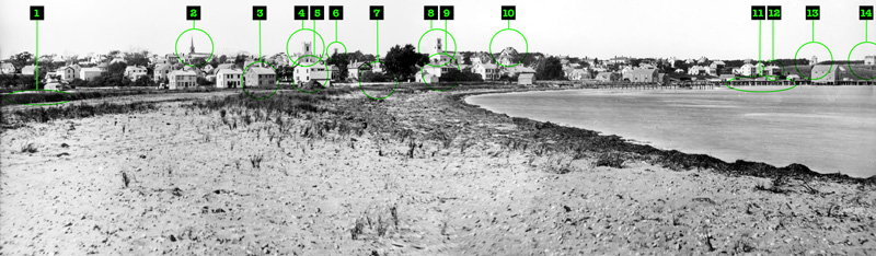


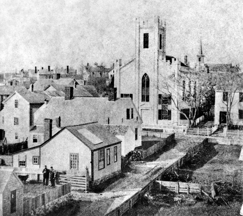


Behold Vineyard Haven — or as many of the locals still called it, Holmes Hole — as it appeared in the late 1870s. This photograph was taken on two plates from what is now Beach Road, roughly near the current offices of the Martha’s Vineyard Times, some 150 years ago. It depicts more than half a mile of Vineyard Haven skyline, from the neighborhood near the top of Causeway Road on the left to nearly the vicinity of present-day Tashmoo Avenue on the right.
The Fall River Daily Evening News described the village in September 1871: “A word for Vineyard Haven. This little town — formerly Holmes Hole, in the town of Tisbury — is a gem set alongside one of the sweetest little harbors of our coast. The houses wear an air of thrift and neatness rarely seen, and not to be expected on an island remote from the culture of large towns.” There was no running water, and no electricity, when this photo was taken. The first telephone poles were still a few years in the future. The town had been briefly connected to the mainland by electric telegraph via a submarine cable in the late 1850s, but it had since been long abandoned.
This photograph was taken just a few years before the great fire of August 1883 destroyed the entire downtown section, but the vast majority of the buildings seen here were lost afterward, in the 20th and 21st century, to subsequent fires, hurricanes, renovation, and commercial sprawl.
Beach Road (visible as a scant dirt road on the left) had been laid out some 40 years before, but for most of that time it extended only as far as the present shipyard, where a marine railway then stood. It wasn’t until the early 1870s, shortly before this photo was taken, when at the urging of the Rev. H.B. Marshall of the Baptist Church (who was tired of the eight-mile circuit around the head of the Lagoon to reach Eastville), the state finally passed an act “to Build a Bridge over the Canal or Creek Leading from Holmes’ Hole Harbor to Lagoon Pond.”
In 1870, a movement arose to change the name to something other than Holmes Hole. Although our esteemed port was located close to Woods Hole, Quick’s Hole, and Robinson’s Hole, the locals were evidently tired of living in a hole. One of the first popular suggestions was Holmes’s Haven, according to a report in the Boston Evening Transcript, but it didn’t quite stick. A public meeting was ultimately held in early 1871. “About 250 people were present,” reported the Fall River Daily Evening News, “and on balloting, two-thirds were in favor of the place being named Vineyard Haven, and most of the others voted for Tisburyport.” The postmaster-general was petitioned to change the name of the Post Office, and so the name was made official. “The name of Holmes Hole has been changed to Vineyard Haven,” reported the Republican Journal newspaper of Belfast, Maine, “but Mr. Holmes will have his hole there all the same.”
Indeed, it took years for many residents to accept the name change. The Chicago Tribune observed in May 1873, “There is one circumstance in connection with this change of names to which I cannot refrain from alluding: The women call it Vineyard Haven; the men obstinately adhere to the old name, Holmes Hole. This illustrates very clearly, I think, the elasticity of the feminine mind over the masculine in its ready adaption to changes.” And nearly everything else has changed since.
From left:
1) The black wedge on the left is the shallow vestige of Bass Creek, which once served as the navigable entrance to the original inner harbor in the Lagoon. But 40 years before this photo was taken, the sloop Zeno was sunk at the bottom of Beach Street to completely block the old waterway, allowing the first segment of Beach Road to be built. Until it was completely filled in the early 20th century, Bass Creek’s idle waters reached all the way to Five Corners.
2) The Association Hall was built in 1844 as a Congregational meeting house, but by the time this photo was taken, it had become the Tisbury Town Hall. For many years the town fire department was housed here, too; the bell in the cupola was rung to alert town residents to a blaze. This building remains our Town Hall today, albeit shorn of its steeple, cupola, and bell in 2018.
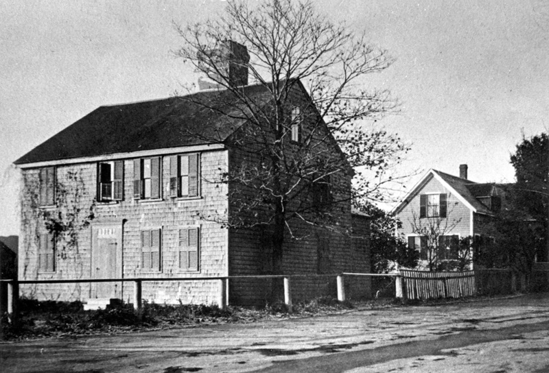
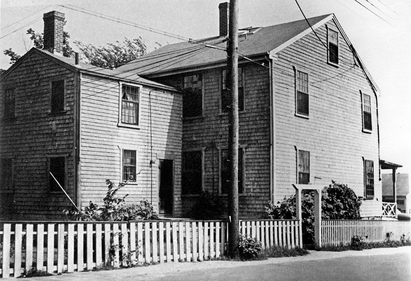
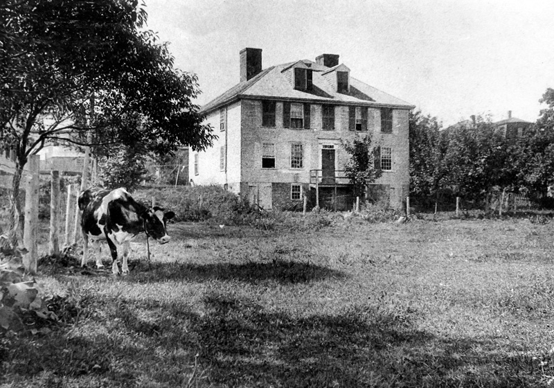
3) This house, known as the “Nye House” or “Elisha Luce house,” was built before 1818. It was at one time a store run by Elisha Luce’s wife, popularly known as “Miss Happy.” But by the time this photo was taken, it was owned and occupied by widow Charlotte (“Lottie”) Nye and her two teenage daughters — one of whom, Lucy (Nye) Cooper, inherited the house and lived here until the 1938 hurricane blew its roof clean off. The house was subsequently torn down, and the Post Office parking lot is at this site today. Note the Nyes’ outhouse, nearly at the intersection of Five Corners.
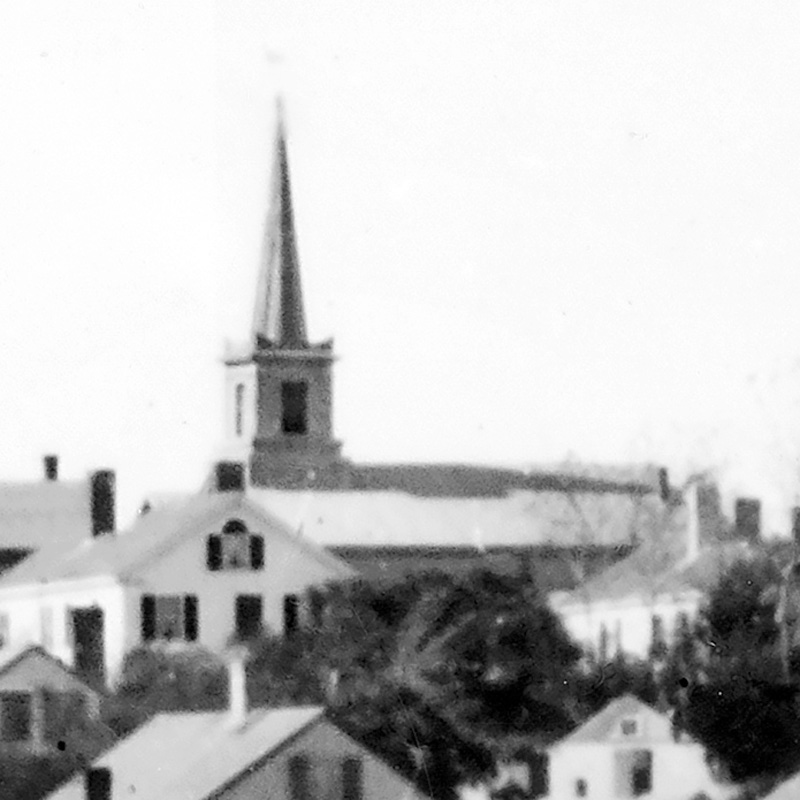
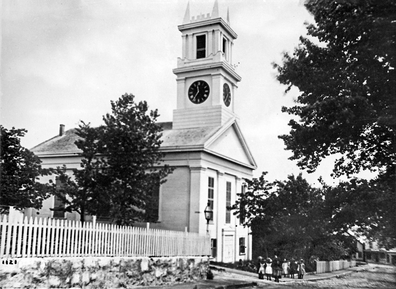
4) The broad white Baptist Church was Main Street’s most visible landmark for more than half a century. It stood on the corner of Main and Spring Streets, about where the Beach House housewares shop stands today. The church was large enough to maintain stores underneath; it also contained an auditorium. The church burned to the ground in the great fire of August 1883 that turned the whole street to ash. The New Bedford Evening Standard reported at the time, “The bell of the Baptist Church tolled as it fell, and was broken; yesterday, hunters for relics broke it into small pieces, all of which have been carried away.”
5) The Seth Daggett House on Beach Street was built in 1801 for Capt. Seth Daggett, a pilot who was an able political leader as well as a strong legal advocate for the rights of Vineyard pilots. His son Leander is said to have introduced the first rubber shoes on the Vineyard (from the Brazilian city of Belém in Pará), as well as the Island’s first merino sheep (rescued from a wrecked vessel). But by the time this photo was taken, the house was occupied by Daggett’s daughter Georgiana Calhoun, a young widow raising her teenage daughter, Mary. It was moved down Beach Road onto the Tisbury Wharf Co. property in the early 2000s.
6) For about 75 years, the Tisbury School was located on Center Street, where the town tennis courts now lie. Built in 1854, it eventually consolidated the number of Tisbury schools from seven to one. In 1929, a new school was built on West William Street, and this old building, expanded several times, was finally demolished.
7) A nascent Five Corners (or at least four of them).
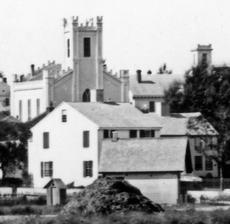
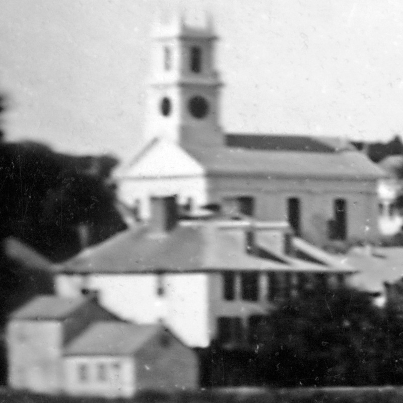
8) The Methodist Episcopal Church, built in 1845. It burned down in 1922, and the new stone church was erected in its place. The Boston Globe, in a story headlined “Old Church Burns, Townsfolk Sleep On,” reported that when the janitor smelled smoke at 7 am on a Sunday morning, he rang the church bell to call for help. But as church bells on Sunday morning were not unusual, no help arrived. By the time he ran home to use his telephone, the flames were dancing nearly 50 feet above the roof.
9) The Great House, built by ferryman Abraham Chase in the 18th century, was one of the very first houses built in the village. It stood about where the public restrooms are today near the police station. It originally stood close enough to the water that an 1812 storm reportedly drove a brig’s jibboom right through its side. Early 20th century writer Martha Norris told the story of one memorable party given here: “A fiddler having partaken too freely of the flowing bowl, kissed Violet, a servant, which so enraged the fiddler’s wife that she snatched the fiddle from his hands and smashed it over the balustrade in the hall, and then herself dropped dead.” In 1922 the building was taken apart and moved to West Chop, where it still stands.
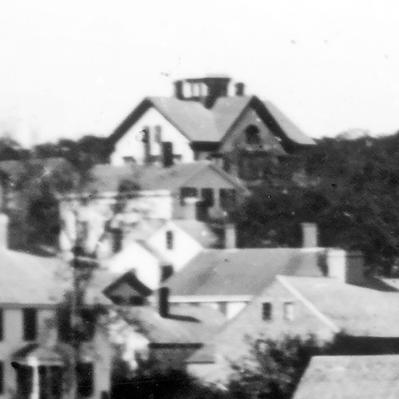
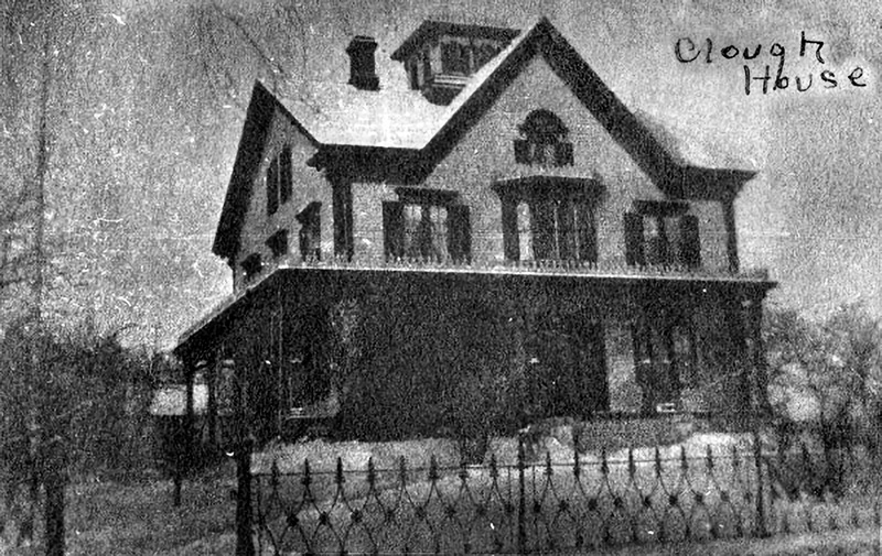
10) The Clough House, also known as the “Capt. Benjamin Cromwell House,” still stands on William Street behind its Victorian iron fence. Built in 1873, it was brand-new when this photo was taken. Capt. Cromwell had served as skipper of the side-wheeler steamers Eagle’s Wing and Monohansett (which he also helped design), and he would eventually sit on the board of the New Bedford, Martha’s Vineyard, and Nantucket Steamboat Co., the predecessor of the Steamship Authority.
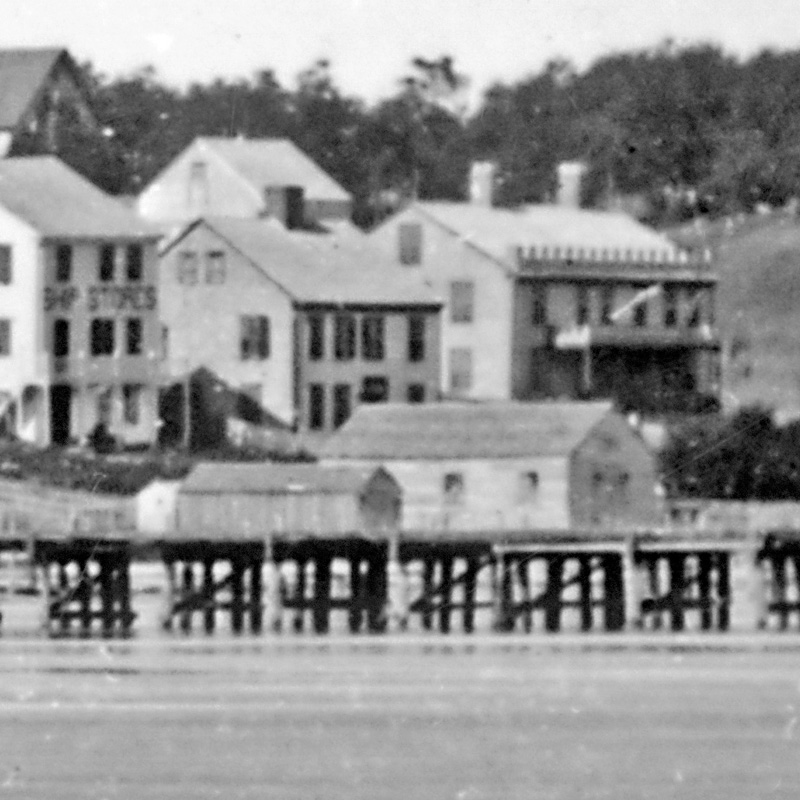
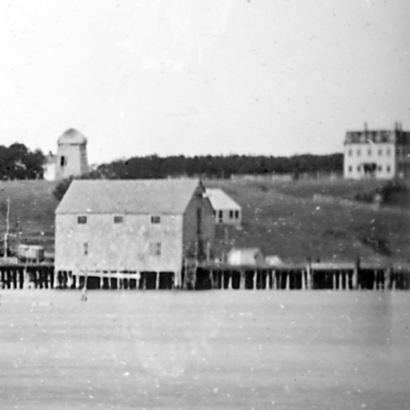
11) The first Union Wharf was built about 1834, at the location of the modern steamship wharf. Ferry service to Vineyard Haven at the time this photo was taken would have likely included the paddlewheel steamers Island Home, Monohansett, Martha’s Vineyard, and River Queen. The building on the end, managed by the wharfinger, served as the ticket office and waiting room.
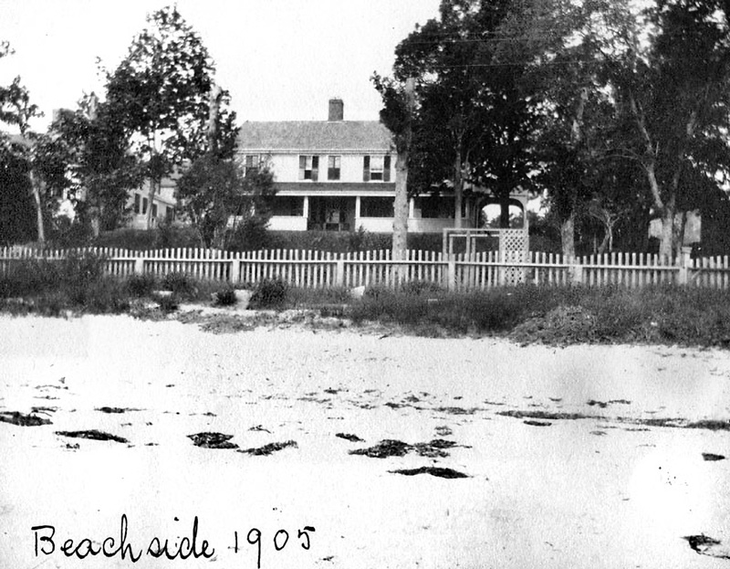
12) Beachside, known also as the “Thomas Dunham House,” still stands where it was built here in 1802 between Owen Park and Crocker Avenue. “At one time the house was kept as a tavern; from a post swung a sign upon which the rising sun was painted,” Norris noted. At the time of this photo, the building was owned by widow Mary Dunham, daughter-in-law of the original owner. It would later become known as Beachside.
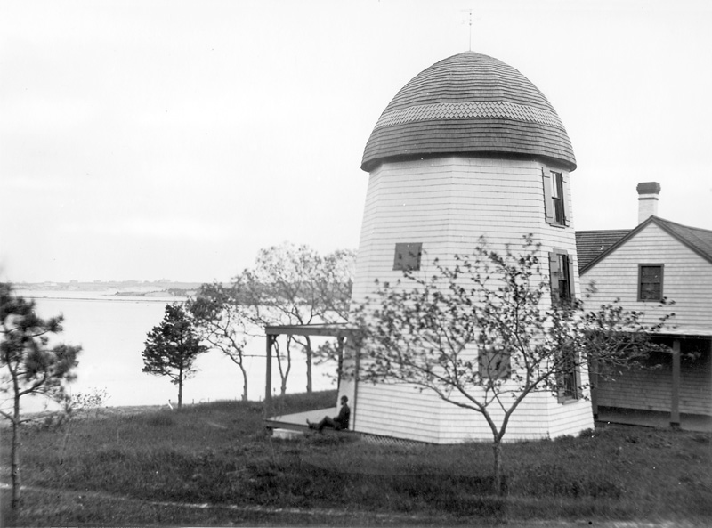
13) The Mill. Built in the early 19th century, the windmill originally stood near Spring Street, where it served as a landmark visible to ships entering the harbor. It was moved twice before arriving at its final location, seen here.
14) The short-lived Grove Hill Seminary was built in 1870 by the Rev. H.B. Marshall, pastor of the Holmes Hole Baptist Church (4). It was a private school whose alumni included Harriet (Eaton) Goldberg and Ellis Manter, both of whom bequeathed substantial sums which still benefit Vineyard youth today. By the time this photo was taken, the school had closed and become the Grove Hill House, a popular summer hotel. It stood across the street from the Unitarian chapel, and was demolished in the late 1930s or 1940s.