

January and February are too chilly for sunbathing on the beach, but you can still bundle up and take a walk to get outdoors in all seasons. From the glacial moraine’s rocky hills and sweeping views, to the outwash plains and shores, the Vineyard has many landscapes beyond its beaches. The Island’s wealth of natural environments has been preserved by a variety of conservation groups over the years, and a few walks will help you begin to explore them, with some snippets of historical interest along the way.
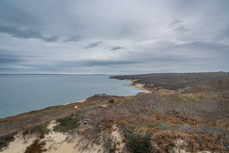
The Menemsha Hills reservation is a popular and vigorous hike. It climbs up to one of the Island’s highest points then winds down to the rocky shore, with overlooks and woodland paths along the way. From the parking lot, I bear left around the Harris Loop and up to Prospect Hill to enjoy the view from Nomans Land to the south to the Elizabeth Islands and the distant mainland shore of Buzzards Bay to the north. At 308 feet, it is the Island’s second-highest point — nearby Peaked Hill is 311 feet high — but the pile of rocks here edges it into first place. From the hill I turn back down the rocky trail and bear left around the Nashawahkamuk loop. A side trail leads down to the beach where the shore is lined with ankle-twisting rocks. If I have plenty of time and energy to spare, I’ll venture down, but I usually continue along the trail to the Great Sand Bank overlook, which provides another sweeping view of any ships sailing in Vineyard Sound.
Next comes the trail down to the brickyard. The trail opened in 2020, allowing visitors to see this landmark up close . . . but not too close. The chimney’s weathered bricks still stand tall, but they’re precarious and the area is roped off. You can also see old stoneworks and the wheels that powered the mill, and follow a gently sloping trail down to the shore. After a good look around, I trek back up the trail and turn left at the end to head back to the parking lot. Although this isn’t a terribly long hike (about 3.7 miles as described, without the walk down to the beach) allow plenty of time for it, at least an hour and a half.
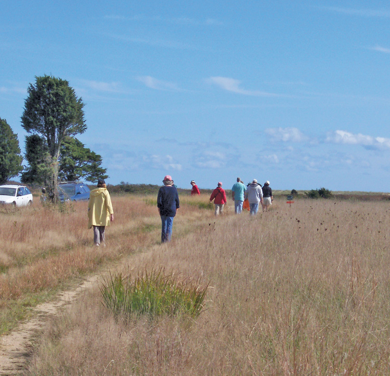
On the far side of Chilmark, you’ll find a very different landscape. To get to Quansoo Farm, you’ll need to drive a mile and a half down the Quansoo road. (In case you were wondering, Quansoo means “eel” or “long fish” in the Wampanoag language.) When driving down a single-lane dirt road like this, be mindful of the etiquette: pull over into the turnouts when you see oncoming traffic. In theory, cars heading toward the main road have right of way, in practice, whoever has the most convenient turn-out should give way. It is common courtesy to thank whoever pulls over with a smile and a wave. It seems to me that those who drive by with gazes locked forward are clearly not from here (that, or they’re harboring some ancient grudge against me).
Quansoo Farm is the site of the historic Hancock-Mitchell house, believed to be one of the oldest houses on the Vineyard. Sheriff’s Meadow Foundation, which owns this property, has been restoring the house and is using some of the fields to grow crops. The path here is flat and wide, tracing a course between the farm fields and the shore of Black Point Pond. An osprey nest stands at the edge of the woods, and Canada geese and swans are often seen on the pond. The trail also winds through the “picnic woods” where old oaks grow low, stunted by the wind and sandy soils. With a side route to the shore of Tisbury Great Pond, the walk is only 2.2 miles, an easy walk unless the wind off the ocean is particularly bitter that day.
For our final walk, we’ll leave the coast to delve into the Island’s oldest and largest conservation area, the Manuel F. Correllus State Forest. This 5,200-acre preserve was created in 1908 to provide a safe habitat for the heath hen, which became extinct in 1938. Despite the loss of the heath hen, the forest remains an important wildlife habitat. The paved trails along its perimeter are popular with casual cyclists, but the smattering of paths leading into the forest’s interior are less well-traveled. Even in the height of summer, a walk here can reliably take you away from the clamor of other people (except on Friday and Sunday evenings in summer, when the calm is broken by the roar of private jets whisking people to and from their Island retreats).
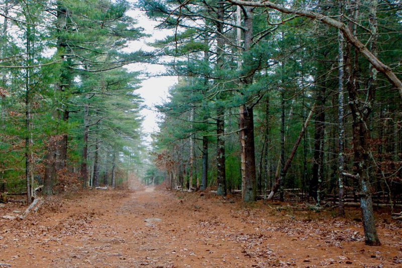
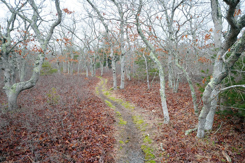
I set out from the parking area on the Edgartown-West Tisbury Road at the Edgartown end of the State Forest, and follow Fire Road 12 a short distance north to the beginning of the Red Trail. The Red Trail runs roughly parallel to the road, and eventually reaches Quampache bottom, one of the long valleys that runs north from the fingers of the ponds along the Vineyard’s south coast. The Quampache Trail is named for a character in Wampanoag stories, in which Quampache is the mother of Tashmoo. The trail goes through a deep pine forest, a peaceful place. At its northern end, it crosses a broad meadow — a good place to look for hawks — and meets Dr. Fisher Road, which is now a walking path. A right turn here will bring you back to Fire Road 12, and the beginning of the walk. This route is about 4.6 miles of mostly flat trails, and I recommend carrying a map or using your phone’s GPS, because these trails can be a bit confusing — the fire roads tend to all look the same, as they were built for utilitarian purposes, not scenic beauty. Still, as a place to get away from it all, the State Forest is a gem.
There are many more wonderful places to walk on the Vineyard, and it would take a book to cover them all. Fortunately, that book has been written: “Walking Trails of Martha’s Vineyard” by William Flender is available at the Wakeman Center and a few Island retailers.
For an up-to-date, 21st century resource, use the free Trails MV app, found at sheriffsmeadow.org/trailsmv-app. To find more information and trail maps for the walks mentioned in this story, check out the following links: thetrustees.org/place/menemsha-hills or sheriffsmeadow.org/property/quansoo-farm or mass.gov/locations/manuel-f-correllus-state-forest.